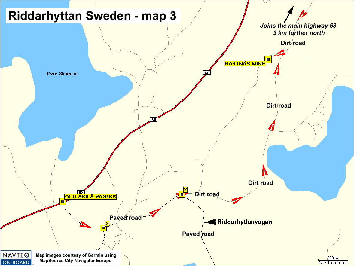
The Old Skilå works (N59 49.99 E15 32.99) are undeveloped and can be easily missed by an unalert traveler. A parking lot is available for stopping and visiting. Drive 7½ km southwest of the 68-233 intersection to reach this site.
The famous Bastnäs Mine, originally an iron mine, was the original source of cerium - N59 50.75 E15 35.34.
There are two routes to the famous Bastnäs mine, from the north or from the south.
From the north: Driving 2 km south from the intersection of highways 68 and 233, a dirt road turns left (east) at N59 52.064 E15 36.860 (intersection "1" of the previous map 2). South on the dirt road by 3 km takes on to the turnoff to the right (west) where the Bastnäs mine is 100 meters further.
From the south: Turn southeast at the Old Skilå works, onto a paved road . Drive southeastward for 1½ km to an intersection with a dirt road (intersection "2," N59 50.01 E15 34.38; don't turn prematurely, there are other dirt roads turning off). Drive 1.8 km north on the dirt road to Bastnäs.