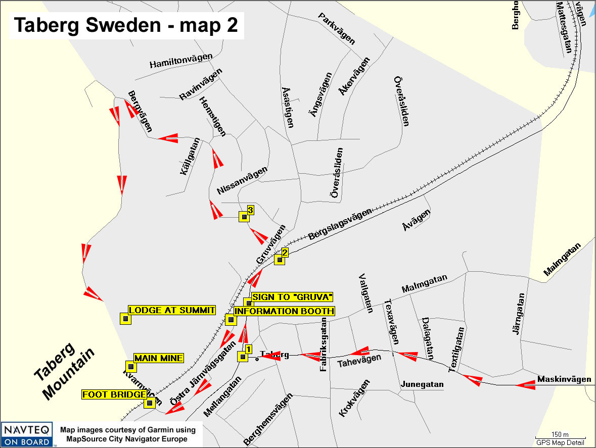
Directions:
One drives westward into the town of Taberg on Tahevägen (used to be Barnapsvägen).
At Intersection "1" (of Tahevägen and Bergslagsvägen,
N57 40.67 E14 05.29), turn right; after 150 meters a sign (N57 40.76 E14 05.30)
shows the directions to "Gruva" (mine) and the associated sites at
the foot of the mountain. Follow Östra Järnsvägsgatan to the
Information booth (N57 40.73 E14 05.25) and the footbridge (N57 40.59 E14 05.00)
leading to the main iron mine (N57 40.65 E14 04.95), which is at the foot of
the magnetite cliff. (There are other mines right and left of the main mine.)
To reach the summit, one continues north from the same "Gruva" sign
for 150 meters to Intersection "2" (N57 40.82 E14 05.38; may be marked
Nissanvägan or Bergvägen) and turn left; continue on this road 150
more meters and turn left again at Intersection "3" (N57 40.89 E14
05.29); continue on 1.4 km further to the parking lot (N57 40.78 E14 04.84;
not shown); walk 150 meters further to the lodge at the summit (N57 40.73 E14
04.93), which is approximatley 100 meters higher in elevation than the town
below.

