Ekaterinburg-Beresov, Russia/ekatberezov060
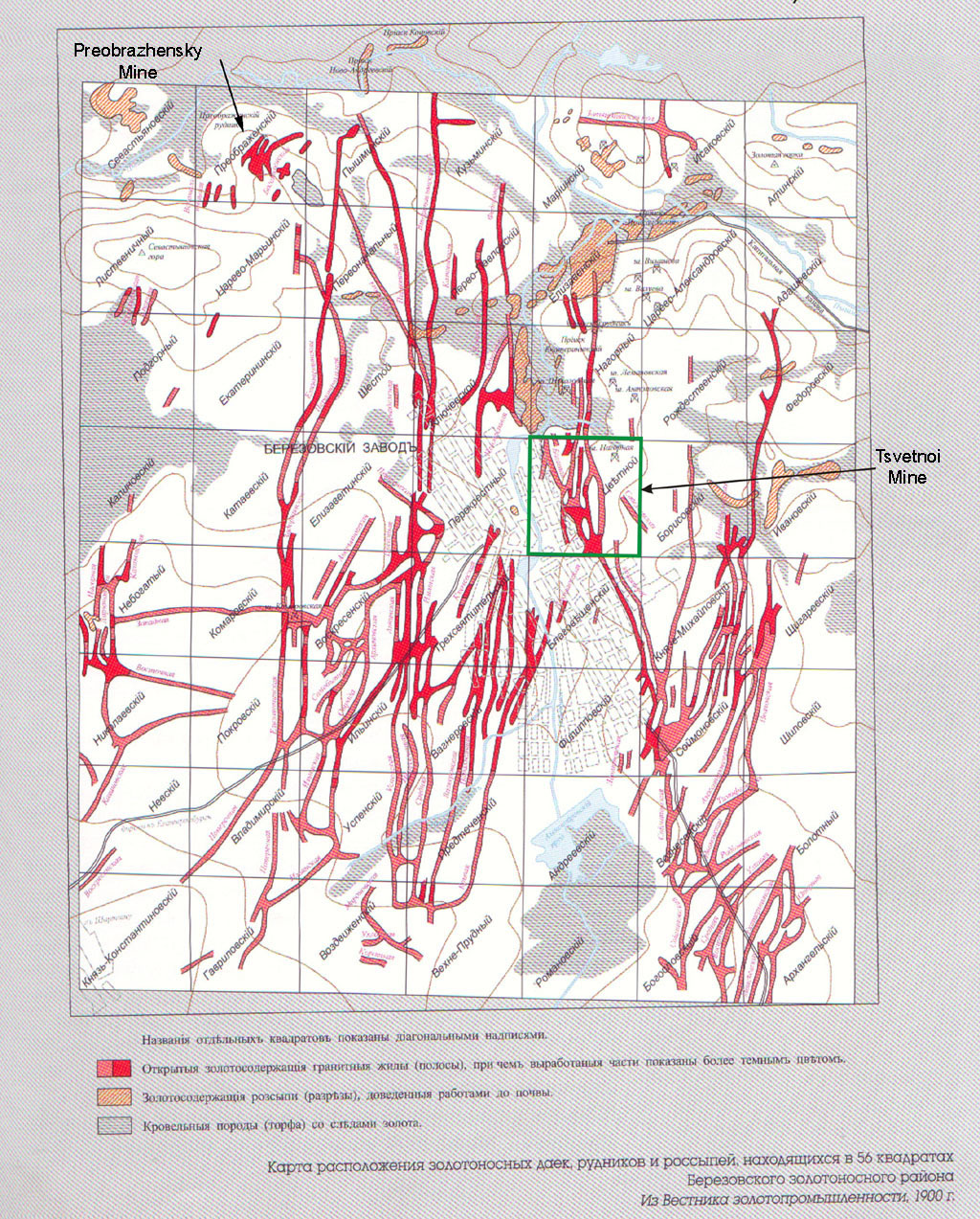
Previous | Home | NextThis shows the Berezovsky orefield again, but with an additional area identified, the Preobrazhensky area in the upper lefthand corner. This mine started up in 1797 on Preobrazhenskaya Gorka (Transfiguration Hill), about four versts to the northwest of Tsvetnoi. This was even richer, both in gold and in crocoite, than Tsetnoi, and furnished many fine specimens for museums throughout the world.
On the map, brown contours show hills, notably the Preobrazhensky (upper left) and Uspenskaya (next to Tsvetnoi).
The key at the bottom of the map was:
Red - dikes of gold-rich quartz veins, furnishing gold mine shafts (dark red already worked, light red active)
Orange - Lake beds used to mine surface-gold in soils, primarily using sluice boxes.
Mauve - Gold found in peat beds.
Map, courtesy, Ivan A.. Baksheev.
